Friday, February 29, 2008

February 28, 2008

Breakfast was so good yesterday, I did it again. Then I headed north through the desert until, at Silver City, NM the elevations started increasing and so did topographical changes. Gila and Apache National Forests abut at the border between NM and AZ.

I lived in Phoenix for a year (’96-97) but never saw the desert in bloom during that period. The hills were covered with non-brown colors – in one area, the north face of each hill was a different shade of yellow or orange as it was covered with wildflowers. It made me question my recognition of the city as I drove in.

I’m staying with David and his father for a few days (and waiting the arrival of lance on friday) – the three of us made a trip to costco and got enough vegetables and meats to last weeks, so we grilled and ate outside by the pool.

Pic/Map: Didn't I see this road in a mazda (zoom zoom) commercial?


Forensics
Today Miles: 334; Trip Miles: 10,407
Starting: Deming, NM
Ending: Fountain Hills, AZ
Route: 180N, 78W, 191S, 70W, 60W, 182ndN, 87N
Longest Coast: 4mi
If I had a bar at the foot of Pinal Mountain: S. Pinal Tap
Location of that joke: Tonto National Forest

February 27, 2008

When I was a kid, my father used to ask, “do you know the difference between a good haircut and a bad haircut?” and of course the answer was, “about three weeks.” Considering my father was also my barber, it wasn’t the type of joke that inspired confidence.

Restaurant Review: If you are ever in Deming, NM and was to have a fantastic breakfast, you don’t have to go any further into town than the diner at Grand Motor Inn. It is actually a hangout for the older crowd of Deming, where they can gossip and joke and laugh over a cup of coffee – it doesn’t hurt that that motel proprietor Ed Khanbabian is running for Municipal Judge and is constantly working the room gladhanding. That doesn’t take away from the delicious Spanish omelet (I choose green rather than red sauce) with hashbrowns and sourdough toast. While it comes out as an indistinguishable mass of eggs and vegetables and starch and melted cheese, the contrasting textures and flavors of the smothered omelet against the hashbrowns. The mother daughter waitress team is never without a coffee pot leaving the patrons never without fresh hot coffee.


Numbahs
Today Miles: 0
Candidates for Municpal Court Judge: 4
Date of election: March 4
Song: ‘You’re so vain’ by Carly Simon
Clouds in my coffee: 0

Tuesday, February 26, 2008

Februrary 26, 2008


A windy night makes it easy to get up early when you are sleeping in a tent. Good though – my wheels were turning before 8am which made for an easy day to make miles. The first 250 miles only involved a few small towns, gas management is key in West Texas because many of the smaller towns don’t have gas stations. Oddly enough, halfway between Marfa & Van Horn (74miles), there is a small building on the side of the road that is a Prada outlet! Sure, it is enough to make a person turn around, and then after reading the placard to learn that it is an art installation from 2005 – but with the nearest police station 38 miles away, the bags and shoes would be a tidy getaway.

I stopped at Hueco Tanks (near El Paso) to do a little hiking. It is a historic site dating back tens of thousands of years where the first inhabitants of the area painted the caves. It was the first park I’ve ever visited that required an orientation video. Lots of rock climbers bouldering around the formations.
Pics: a) just doing a little shopping; b) climbing aid at hueco tanks; c) if rockclimbing required wearing a tie, would hippies still do it?


ecStatics
Today Miles: 475; Trip Miles: 10,073
Starting: Terlingua, TX
Ending: Deming, NM
Route: 118N, 90W, 54N, 62W, 10W
Distance from Terlingua to Alpine: 78 mi
Gas stations / towns: 0
Border patrol stops: 1 (65mi N of Terlingua)
Questions: 5
Total immigration stops today: 2
Song: ‘Sometimes (Lester Piggott)’ by James

Monday, February 25, 2008

Februrary 25, 2008

Good thing they aren’t holding elections – I would run for mayor of Terlingua, TX. I have decided to stay here for a second night. I started the day by heading over to Santa Elena for a nice hike. Then I did a drive over to Presidio, TX along the Rio Grande along what I will say is the most naturally unsafe road that I have driven to date. Presidio wasn’t unlike most of the other small towns I’ve visited, with the exception of the large number of white SUV’s with logos on the doors – evidence of a border patrol station. While I didn’t find anyone speaking English in presidio, I also saw a lot of cars full of groceries and comestibles heading south.

Profiler: If you want to spot an RVer (sorry George & Dawn) here are the tell-tail signs – over fifty, white, from a state (or province) north of Nebraska, teva sandals, jean shorts, tan / sunburn. Common conversation topics: how low/high the prices are relative to [insert Canadian province], where I am keeping residency so I can keep my [insert hunting / tax / child college explanation]. However, RVer’s are accepting of all races, ages, and genders wherever they are.

Jerkalert: Being a jerk driving around in a truck for a couple weeks, it gives a body a chance to see a few things and ponder a few more…. WARNING: Political rant: [Hugh, go ahead and skip] Immigration – I invite anyone who supports the idea to build a fence, to come to Southwest Texas to see exactly where this multi-billion dollar fence would live. I am wondering if, when considering the choice to go through the desert, the mountains, and the river, if a fence is going to really serve as the incremental impediment that causes the contemplative border jumper to change his/her mind? A fence is a passive aggressive response to an issue that America doesn’t want to face – the more indignant we are that we have to speak Spanish at wal-mart, the taller the fence will be. Sure the border states will support the idea – if you told them you would invest a billion dollars into rubber dog-crap factory, they wouldn’t complain about that either.

Insert parable: In india, they had great trouble dealing with the cobras in their village – to get rid of the cobras, they didn’t try to build snake traps, they instead got rid of the mice and rats. Without prey to lure them into the villages, the snakes stayed away from people. I encourage people to avoid thinking of fences, and start taking daily activities to dissuade immigration. The most passive approach would be to ask your homeowner’s association to not assign the landscaping and maintenance contracts to companies that don’t comply with current I-9 requirements. Then, write to your congressman and ask them why I can’t find any sort of recycling anywhere in texas!

Pics: a) the mack homestead; b) driving into santa elena canyon; c) walking into santa elena canyon; d) a flower in the rio grande river basin; e) my camera has a ten second delay, then shoots three one second pics - this is the least funny of the pics showing me running from the timer.


Numeros
Today Miles: 181; Trip Miles: 9,598
Starting: Terlingua, TX
Ending: Terlingua, TX, via Presidio TX
Route: 170
High Temp on beast thermo 2/25: 96
Low Temp on beast thermo 2/15: -3
Surprising Cultural Group to see in Presidio: Menonites
Common trick in TX gas stations: ‘see inside for receipt’
Drama in Presidio: brush fire
Most common shortage at Hobby Lobby in sw tx: burnt umber oil paint


Februrary 24, 2008

Drove south through the desert, stopping only at the town of Marathon long enough to walk through a couple of galleries (pricey for the product). Then more south to Big Bend National Park. I didn’t really plan on it, but just a few miles into the park there was a two mile hike to Dog Canyon – so I went ahead and did the round trip. Unfortunately the last third of the trail was in a dry creek bed that alternated between sand and rocks, all the while only providing a view of the walls of the creek – until it did run through a canyon which was lined with towering steep red rocks.

I had to do some work so I gambled and went to Terlingua Ranch – hoping that I would not only be able to stay there, but have access to highspeed internet to avoid driving seventy miles north to Alpine for the night then trek back Monday evening to spend more time at big bend. The map didn’t warn me, but ‘road’ is an overstatement – it was more of a sandy path with no marking that went over yonder. An hour later I made it to the ranch – RATS! No internet, but a really friendly woman that I chatted with for about fifteen minutes. She saved me going all the way back to Alpine and pointed me to the nearest hotel with wi-fi, about thirty miles away. If only there was Verizon coverage here.


Today Miles: 159; Trip Miles: 9,417
Starting: Fort Stockton, TX
Ending: Terlingua, TX
Route: 385S, Terlingua Ranch Dirt SW, 183S
Cost of entry to big bend: $20 (7 day)
Hiking Temp: 80
SPF Worn: 0
Current Skin-hue: sutter home white zinfandel
FM radio stations in Terlingua: 0
AM radio stations: 1 (1260am out of Chihuahua)
Cost to stay at the Big Bend Motor Inn room: ~$89
Cost to camp behind BBMI: $12.00
Cost of 6minute shower: $2.00
Filling and delicious dinner at Chile Pepper Café across the street: $9.82 (pre-propina)

Saturday, February 23, 2008

February 23, 2008

The stars at night, are big and bright: The sounds of the coyotes howling and barking wasn’t exactly a lullaby, so eventually I got up and went for a walk. The full moon rose around 8:30 and lit the landscape in a way that it looked like night in the old John Wayne movies where they just put a filter over the camera. It was cool. It also put me nicely to sleep.

When I lived 150 years ago, I was definitely the old scraggly guy in the last wagon with a pot of beans going and some country aphorisms for anyone who would listen to me. I had a hearty breakfast, did a quick hike in the park, and headed to Abilene where I could use the library and get a used coffee mug so my beer mug wouldn’t have to do double duty going forward.

Pics: a) cookies' pots; b) boyle's law; c) grass; d) cotton fields; d) me, the beast, and JC in Ballinger


Today Miles: 421; Trip Miles: 9,258
Starting: Breaks State Park, TX (near Margaret)
Ending: Fort Stockton, TX
Route: 6S, Random Dirt SW, 83S, 67W
Number of roadkill tallies: 0*
Number of times I refrained from tallying: >20
Famous American from Abilene, Tx: Jessica Simpson
Famous American from Abilene, Ks: Dwight David Eisenhower
March 16, Midland Texas, The Ranch Nightclub, entertainment: Micro Wrestling Event (midget wrestling – http://www.microwrestling.com/)
Other tidbit of wisdom from The Ranch Nightclub website:
Other men who were weaker and less skilled at hunting, learned to live
off the conservatives by showing up for the nightly barbecues and doing
the sewing, fetching and hair dressing. This was the beginning of the
liberal movement. An interesting evolutionary side note: some of these
early liberal men eventually evolved into women.

Liberal achievements include the domestication of cats, the trade
union, the invention of group therapy and group hugs, and the concept of
democratic voting to decide how to divide the meat and beer that the
conservatives provided.
Number of comments I can make about the quote: 0**


*Today was a count-free zone.
**Except that.

February 22, 2008

I spent the morning dealing with a point of contention between the Internal Revenue Service and I. I know that I was wrong on the form, but that doesn’t mean I’m not going to write a kneescraping letter begging for mercy. The night before I had tried to go to ‘I love this bar & grill’ by some country music star, but they were making a racket with some sort of singing contest so I went next door to the Bass Shop – a somewhat lesser attempt at the palace to the outdoors created by Cabela’s. So this morning I got off the dime about a camping stove I had been hemming and hawing over and went ahead and got a lantern for good measure.

That stinks: I drove southwest and enjoyed watching the thermometer periodically tick up a degree until I was over forty degrees! Unfortunately with the warm weather, some of the less pleasant aspects of the road are brought to the fore – no longer masked by a few inches of snow, or having their rotting smells frozen inside, the roadkill was omnipresent. During the short trip between Apache and Lawton (maybe twenty miles) I tallied no less than fourteen skunks that were smashed. [I chose skunk because they are easily recognized by stark black and white that avoids confusion with most other road kill – unless pepe lepew was out, and they normally are small enough to stay in the vicinity of the road bed, and when all else fails the smell was the secondary indicator]

I stopped in Lawton long enough to stretch my legs in a local park near Fort Still, and I was amazed by the prairie dogs – there were hundreds of the little bastards, everywhere! They were tame enough that they didn’t flee into one of the thousands of holes around the park immediately, instead they all communicated to each other about my presence with tail wagging and little barks that were like chirps. The devils were cute as hell to watch run – but seeing the destruction the bring, I can see why they are trapped, shot, and vacuumed. Somehow I got turned around in Lawton with a couple bad turns and ended up in the school zone at last bell – hundreds of little bastards, everywhere, but not as cute. So I ended up taking a revised route south rather than west (I refused to backtrack through the school zone).

I cruised through some beautiful plains of Southern Oklahoma and into the panhandle of Texas. It was downright beautiful outside, and I decided that I was feeling pretty good and I would go ahead and try camping – so I stopped at a grocery in the next town, and also visited a wal-mart, and started making tracks. I have complained in the past about getting to a town late – there is no option with camping. I haven’t used my tent in years (not the one lance and I drove cross country with – that was lost in SF, and not the one I got a few years ago – Jin Ah left that one in Hawaii [who brings a tent to Hawaii?]) and I wasn’t even sure I had all the parts anymore. But I made it to the park with about forty minutes of sunlight left, and no park ranger, and not another soul in the park…. Except for a couple of armadillo that weren’t so keen on my arrival. I pitched the tent on a dry, flat, and soft space, did the late check-in paperwork and made camp with about ten minutes before the sun had dropped off the horizon. Unfortunately, while I am only about twenty yards from the restrooms / showers, I observed several piles of presumably armadillo droppings between the tent and the shower, so I am leery of stepping in yet another species’ feces. FYI (for you skat lovers – not ella though) imagine a deer, but constipated.

So, in the spirit of ‘roughing it,’ I fired up the lantern and the stove and made some Kosher hotdogs and chased it with a gourmet beer from the Boulevard Brewery Limited Edition Smokestake Series (no review – beer may have been frozen) while I tuned in a classic rock radio station for eine kleine nachtmusik. My laptop was charged up (via the Beast – love the outlet in the bed) so I nestled in the super sleeping bag I got for Christmas and tapped away this entry.

Movie Review: Last night I made the mistake of letting a movie start, and I can’t turn them off. I was up until 2:30 watching ‘Brick’ – and it was tremendously worth the slow start this morning. I’m no movie scholar, but for my taste it was a great combination of Teen Angst, Pulp Dialogue, and Film Noir – imagine splicing ‘Three O’clock High’ & ‘Heathers’ with ‘The Maltese Falcon’ and ‘Miller’s Crossing.’ The dialogue is indecipherable at first until it is clear (sorta) that it is basically American hackney. Probably not a film for my parents, but it has no boobs and limited f-bombs so it is safe for a Thanksgiving rental that will have the grandparents shaking their heads.

Fun & Games: Can you name the states that have panhandles? (Answer in comments)

Pics: a) Cute little bastard; b) pimp his ride in hollister, OK; c) cribs at copper breaks SP


Today Miles: 232 Trip Miles: 8,837
Starting: Oklahoma City, OK
Ending: Copper Breaks State Park, TX (near Margaret)
Route: 62S, 36W, 5W, 54S, 70W
Exercise in Redundancy: City of Oklahoma City, Oklahoma (official name)
Businesses currently on Do Not Use (DNU – pronounced ‘nyuah’) list: Ramada (product), Office Depot (service)
Cost for camping in Copper Breaks State Park: $10.00 (I waived myself on the $2.00/person use fee)
Semi-scientific tally of radio station genres in OKCity, OK
Christian: 10
Jazz/Classical: 3
Rock / Classic Rock / R&B: 8
Country: 5
Talk / Spanish: 4

Friday, February 22, 2008

February 21, 2008

A place where even squares can have a ball: a point to anyone who can tell me the song from whence that line came – a counter-counter culture anthem of the late 1960’s. by the way, this is like ‘who’s line is it anyway’ where the points don’t really count and the host is a fat white guy. Your hint for the day – I started and ended today in Oklahoma (for only the second time have consecutive travel days ended in the same state – the other was Montana).

Cosmo’s: Trying to patronize the businesses that support the programming I enjoy – I visited Cosmos Cafe at 69th and Memorial where the connectivity was good, the music was great, and the service got me a couple cups of coffee in a reasonable period of time. From there, I took memorial south until it became 75 and then I headed west using the force (and beast compass), parallel to I-40W through a series of interesting and small towns and Indian reservations until the countryside became the edges and then the center of Oklahoma City.

Famous People & Tragic Events: It is interesting to me that towns are put on the map based on the famous people that came from there, or the tragic events that occurred there. It is hard to believe that it has been 13 years since the bombing of the Alfred P. Murrah building. The national monument is tasteful and moving. However, the rest of Oklahoma City merit attention that is more uplifting and enjoyable ie Automobile Alley and the other districts; especially BrickTown where I ended up staying and having dinner at the BrickTown Brewery. (no beer review as the taste-buds of the reviewer are limited by current bout of llness)


Pics: a) one of at least two yanta cowboys waving to me; b) ok city nm, Reflecting Pool and Field of Empty Chairs; c) The Survivor Tree


Games: Match the famous person with the Oklahoma Town that has a street sign or origin sign describing their Okie Heritage… (answer posted as a comment to this entry)

Mickey Mantle
Troy Aikman
Woody Guthrie
Jim Thorpe
Johnny Bench

Spavinaw
Henryetta
Okemah
Prague
Oklahoma City

Today Miles: 206; Trip Miles: 8,605
Price of gas in Prague, OK: $2.99
Cost of 30 minutes parking, OKCity, OK: $0.25
Times ‘she likes it in the morning’ played on country radio: 3
Candidate for Primary Chief of Okmulgee: Tiger
Unpleasant Freeze Experience (mess): Vlasic Kosher Dills

February 20, 2008


I resolved myself to drive south until the temperature gauge in the beast was above freezing. I have spent the past couple of weeks while traveling using the growler I got from Firehouse Brewery in Rapid City, SD - filling up with warm water in the morning and leaving it in my cooler while on the road to keep the grocery contents from freezing.

The great thing about most of the towns in the MidWest is that you can take virtually any road in a general direction, and rest assured that it will keep going in that direction until it ends. I took Holmes south out of Kansas City (driving a couple miles east long enough to get a lottery ticket I had neglected to get last week) until it became simply Rte D. I went east far enough to get on state highway 71 south to Lamar – birthplace of Harry S. Truman the 33rd (32nd according to the site monument) President of these United States. Media References: Jim Carey movie, In Cold Blood, Fletch, Will & Grace.

Advertising: Oklahoma is not unlike most markets where the television networks generate money by selling advertising space to entities that hope to promote their products (& causes) by reaching the masses. For some reason, the Cherokee Nation is a key advertiser in Oklahoma – describing the good deeds the tribe does for the community. I am not sure why they are compelled to do this, but somehow I am going to think it has something to do with gambling.

Gambling: The Oklahoma license plate has the slogan ‘Native America.’ In case you didn’t see it on all the cars, you can count that every county has a tribe and you will know that because there will be a casino that is open 24 hours. I have rethought my position on gambling – I once considered it an unnecessarily regulated activity that caused governments to forego regulatory revenue.

But driving through dozens of Indian reservations and states that allow for legalized gambling – and seeing the way it is ubiquitously, conspicuously, and tastelessly thrust upon the public in every diner, grocery store, and gas station… I can only imagine a cluttered and littered environment – before I even consider the fact that these all seem to be self-sustaining (demand) with potential for ancillary social problems and their related public cost.

Quote: "Man's mind, once stretched by a new idea, never regains its original dimensions." (O.W. Holmes, Sr. 1858)

Pics: a) Ice along a highway cut, b) HST birthplace, c) bowling ball lawn ornaments across from GWC National Park


Max Fax:
Today Miles: 290; Total Miles: 8,399
Morning Temp In KC MO: 8
Wind Chill: -8
Price of gas in Lamar, MO: $2.97
Price of one post card at birthplace of Harry Truman: $0.27
Unpleasant Freeze experience (unusable): Barbasol Shaving Cream
Astronauts from Carthage, MO: Janet Kavandi
Scientists from Diamond, MO: George Washington Carver

Famous battles of carthage:
(c.149 BC): The only major engagement of the Third Punic War, which was a protracted siege starting somewhere between 149 BC and 147 BC, and ending in the spring of 146 BC with the complete destruction of the city of Carthage.

(238): The decisive conflict in the revolt of Marcus Antonius Gordianus Sempronianus Romanus Africanus (Gordian II) against the Roman emperor Gaius Julius Verus Maximinus (Maximinus Thrax).

(533): also known as the Battle of Ad Decimum, fought between the armies of the Vandals, commanded by King Gelimer, and the Eastern Roman Empire (Byzantine Empire), under the command of general Belisarius.

(698): part of the Islamic conquests, fought between the Byzantine Exarchate of Africa, and the armies of the Umayyad Caliphate.

(1861): a battle of the American Civil War, occurring on July 5, 1861 in Jasper County, Missouri. It was the first victory for the Confederate Army in Missouri.

February 18-19, 2008

February 18-19, 2008

These were a couple non-travel days. I worked from the comfort of Kerry’s house in Kansas City and from the local library – where the wi-fi was solid and there are even loaner laptops for visiting patrons!

Kerry and I even went back to PotPie to see James play the accordion again; by coincidence I was in town again for his monthly session. Unfortunately, however, James called in sick! But I can’t blame him, after another good dinner, I went right to bed when we got back to Kerry’s house, because I too was starting to feel under the weather.

Getting sick stinks: By this point, I know when I am going to get sick. It isn’t just the sore from exercise, it is aches in the small of the back and in the hips that don’t come from normal muscle use. I went to bed early and read about a third of the book I’ve been working through (‘disgrace’ by J.M. Coetzee). Over the course of the night my fever kicked in and woke me up periodically – in the spirit of the blog I went ahead and took notes on my neurosis during the fever, but after reading my notes, realized that I don’t know who is reading this, and I don’t need my future employer hiring me merely because I was a future alibi-as-mentally-deficient in the making.

Green Machine Ingredients: Apple Juice, Mango Puree, Pineapple Juice, Banana Pureee, Kiwifruit Puree, Green Machine Mix (spirulina, chlorella, broccoli, gree tea extract, spinach, barley grass, wheat grass, blue green algae, echinacea purpurea extract, odorless garlic), natural flavor.

Monday, February 18, 2008

February 17, 2008

It always snows: When we woke up Sunday morning the heavy rain had turned to thick wet snow covering everything in a thick blanket of white – fortunately it wasn’t bitterly cold so we figured that the orienteering event that Kerry was going to would not be cancelled. Kerry had convinced me to participate in the event, so I can give a first-hand account of this unique sport:

The event was sponsored by the Possum Trot Orienteering Club (www.ptoc.org) – at Monkey Mountain (about thirty miles east of Kansas City). We arrived at the parking lot of the park where there were about five vehicles. Kerry handled the financial transactions – five dollars to participate plus a dollar to rent a compass for me – in the first car, and the participant comes away with a detailed map of the park that outlines the geographic features (eg forest, open field, stream, etc) and topography, a key to the map, and a card with numbered boxes to be marked at each of the waypoints. In the second vehicle, a van-agon with camper fit-out, a second man shares a map with waypoints – depending on the difficulty of the course chosen – there were five different difficulties for this course, Kerry had of course convinced me to do the most difficult (red) course that she would be doing.
You take a couple of minutes to mark your map with the waypoints (control locations) on the guide map – thirteen scattered across the park, and numbered so you have to visit each of the controls in order, and a key to the lettered controls and hints on where they will be found (eg. Ditch, rootfall). The great thing is that this is actually a race – the timer starts the clock when you leave his van for the trail. But since there is a staggered start, and people are doing different courses that have sometimes overlapping controls, it isn’t prudent to spend much time following other people because they may be on a different course, or they might be on a different control, or they may just be bad at finding the controls.

Kerry left the parking lot about a minute before me – and I could have followed her to see where she went for the control, but I took a different route and ended up finding the control with her about the same time – a orange and white flag with a letter code (to confirm that it is the correct control based on your map) and a hole punch with a unique pattern that is used to mark a numbered sheet that comes with the map. From there we only saw each other a couple of times, the weather changed from light snow, to light rain, to cold wind, to eventually sunlight. The weather helped because periodically I would find Kerry’s footprints and it comforted me that I was in the right general area looking for the control.

At control number 5, I passed Kerry and ran north toward control 6. I didn’t see Kerry for another hour as I tried to keep ahead of her by finding the controls and running as much as I could, but the muddy conditions led to a lot of jogging, walking, slogging, splashing, and periodically falling on my ass. Because of the pressure of having Kerry chase me, I felt like Dr. Richard Kimble moving over uneven terrain, hopefully at four miles an hour from the unseen, menacing, US Marshall Lt. Gerard. Just before I got to the 13th and last control, I looked over my shoulder and there was Kerry’s red sweater, her first comment was, ‘why are you covered in mud?’ she shot me with her comment and we laughed and punched our cards and walked back to the parking lot together – we finished with 2 hours and four minutes each. Partially frozen, covered in mud (at least me), and pretty damn tired, we headed into KC for some Vietnamese food (pho) to warm us.

Cabelas: We took a detour into Kansas to visit the most outrageous sporting goods store I’ve ever seen – and while it was probably bigger than most Costco stores (with two levels) it was completely full of things that have nothing to do with soccer or football – this was an outdoors outfitter. The most striking feature of the store was the taxidermy – there were stuffed animals everywhere; birds in the display cases around the counters, hundreds of deer heads lining the walls, and three key features:

1) A faux (not pho) mountain of at least two stories in the center of the store with (all stuffed) bighorn sheep in action climbing up and down, while at the base and in crags leading up the summit were varying levels of dear (mule and white tail), bison cornered by three wolves, a bobcat snaring a rabbit out of mid-air, moose... the display complete even with animal skat.
2) The mule deer room – a room that is filled with over 100 full size deer displaying the different types and sizes of mule deer racks; both typical and non-typical rack types. Many of the record holders for each category were on display with even a couple of human mannequins that every couple of minutes would come to life via animatronics and tell us that the racks on the deer displayed are rare, but there are more out there!
3) The African savannah – here is an alcove that features taxidermy of big game from Africa – lions tackling a zebra that is kicking, two elephants in combat, even a crocodile grabbing at a group of five wildebeest!

Besides being the most amazing store, there was even an olde time shooting gallery where a person can pony-up some tokens and use a rifle that shoots a beam of light at targets scattered across a room for points and bragging rights. Kerry challenged me, but I didn’t have the courage to face her – in the bb gun wars of woodbridge, va, I was usually one of the targets rather than the shooter; and I wasn’t inclined to climb into the display and run around screaming like I did as a kid. I was already too tired and sore from orienteering.

Pics: a) the snowy start at kerry's house, b) check-in process vehicle, c) Kerry, D!) the detailed map (original in color), e) Control #8


February 16, 2008

Down through Iowa: It took me a while to pack the vehicle after spending a week in a single place. Fortunately it was a bright sunny day so I decided to through four bags in the bed of the truck to be dealt with when I was not trying to get the wheels turning. The only significant point I passed was the Mississippi / Missouri river divide – for some reason we take for granted the different watersheds that support us – I wonder if ‘Water Wars’ and other books that predict the next cultural and political conflicts will be about resources like water, will change that under-appreciation? I had my own appreciation when it started raining fiercely a few hours later and I had to hastily fit all the bags in the cab of the beast. Awesome!

Just west of the divide on 30, I passed through the towns of Arcadia, West Side, and Vail – they combine their forces to have a highschool of about 100 students ARWEVA, that has managed to make it to the state tournament for both boys and girls basketball. Many of the people I work with were sure to leave the office in time to go to the town of Denison (home of Donna Reed) to see the games while I caught bits of the games on the radio.


I stopped at every gallery and antique store that I passed taking 59 South – some of them were junk shops and some were just craft stores and others were just closed. When I passed into Missouri I started back tracking over the same roads I’d seen a few weeks ago so I expedited my journey by using the interstate with a brief detour to St. Josephs. Kerry explained the history to me later, that St. Joe’s and Kansas City were approximately the same size and stature in the middle 19th century – until the railroads decided to build their Missouri River crossing at Kansas City – making it a critical waypoint for the railroads and all the industries that relied on rail (especially cattle herding). St. Joe’s never recovered and I saw evidence of a second tier city when I stopped downtown at an ‘antique store’ that was more of a pawnshop / gunshop.


Savoy, Herefords, Grinders: I met Kerry downtown near her office and we stopped at the Savoy Hotel for a cocktail – it is the style of hotel that is unique in its attention to detail with tile floor, textured glass, and dark old wood. The historic hotel was frequented by Harry S. Truman (I love that everyone uses the middle initial) and based on the average age of the clientele, it is still mostly frequented by people who knew him. It was raining fully at this point, good for cleaning off the beast, but a beast for dealing with two cars going to dinner; at Herefords – because the wait was over an hour we had immediate seating at the bar, where unfortunately we were close enough to the taps that when the keg of Boulevard Pale Ale was finished, it sprayed Kerry with a shower of foam. We finished the evening by visiting Grinders – a bar owned by an artist Kerry knows – one of the coolest bars based on the layout, the expansive beers on tap, the friendliness of the staff and the patrons, the music, and the decorations – specifically a ventilation duct that the artist had converted from a simple rectangle to a tapering and twisting metal finger reaching from the floor over the bar about fifty feet.

Several unique beers were sampled, but the first and the strongest was what piqued my interest the most: Maudite by Unibroue (French Canadians, sore-ry) the makers of one of my favorite bottle conditioned beer (carbonation by yeast rather than artificial introduction) La Fin du Monde. The analogy I would make is champagne vs. wine – it is both fermented grape juice but the different types of yeast and the finishing of the product make them almost incomparable. These beers have a much higher alcohol content (7-8% versus the usual 3-4%) but they don’t compromise on flavor to get there – these are rich beers with complex ale flavors that saturate the palette, without too much hoppiness. What was surprising was that the keg dispensing of this normally bottle conditioned beer did not diminish the tiny and abundant carbonation bubbles. Like chimay and other strong beers – limit yourself to one, or make sure that Kerry is going to be the designated driver from the bar.

Pics: a) dividing lines, b) savoy glass, c) savoy glass bearers, d) grinders hvac


Le Stats:
Today Miles: 382, Trip Miles: 8,024
Total Gallons of Fuel Trip to Date: 456.229
Overall Average Miles per gallon (MTD/GTD): 17.59
Air Miles from Paris, France to KC, MO, USA: 4,511.24
Age of Lestat Lioncourt (Ann Rice Character): 247 yrs 101 days
Flying speed of a vampire bat, mph: 4.9
Estimated time Lestat would have to fly to visit me in KC: 921 hours

Wednesday, February 13, 2008

February 11 - 16, 2008

This week I am taking a break from the road and spending some quality time in Iowa attending to some business. I will be sure to update this post with any interesting or amusing events during the week, but I doubt there will be any interest in my professional responsibilities.

Public Policy: If the United States government wants to stimulate the economy, they don’t have to spend a penny – just go ahead and make valentine’s day a monthly occurrence. Instead of lending everyone’s money back to them until the next tax period (with the appropriate inflation adjustment and a couple points to cover the additional burden to the government in administering a wacky program), this will actually be more efficient. Instead of people spending money on things that were probably manufactured in another country (China perhaps?) they would be taking each other out to dinner and supporting singing valentines (today I heard a barbershop quartet) and other service industries.

New Car Feeling: Tuesday the condition of the beast had reached a tipping point – every time I walked by it, or tried to get things in or out of it, I was getting transfer dirt. Normally I’m just fine with some dirt between friends, but my work clothing was starting to suffer so I resigned myself to take him in for a bath. After the dismal performance of the deluxe wash in San Diego, I took the truck to one of those facilities with the large bays and a machine that swallows money and spits out soap, water, tire cleaner, spot free rinse, and seven other settings. I started washing with the high power sprayer and immediately started getting odd results – did I mention yet that it was the day’s high temperature of 9 degrees farenheit? After blasting the ice and most of the dirt off for about six bucks, I started driving toward dinner. When I got to 45 miles an hour, all the liquid on the car froze again, including the sheet of water on the windshield leaving it useless for seeing out; after it broke a seal of ice, I managed to roll down the driver’s side window and endured the freeze until I could pull over and let things thaw and dry. We also confirmed that horns on several cars in town are currently functional.


Laundry: Note to self RE: doing laundry in cold climates during the winter – get powder detergent. Who would have thunk that liquid detergent would be a complete solid after a couple days in the back of my truck?

Checks: I have seen (and waited for) more people writing checks in the past week than I have in months before. Not only at the grocery store, but also at restaurants and convenience stores. I commented on it with the bartender at Denny’s (not part of the chain) and she had never given it a thought. She said they take dozens of checks a day and have never had a problem with them bouncing.

Monday, February 11, 2008

Februrary 10, 2008

Getting to the plains put me north of my plan to travel through Kansas today (Kerry is a member of the Kansas Explorers – a club that dedicates itself to exploring the state!), so I had to cut through Nebraska to get on Rte 36 and cruise along the northern border of the state. I didn’t get to see much of the countryside because there was thick fog for the first fifty miles. When it opened up, there were some snow flurries and then mostly open fields with occasional feed lots and speed zones indicating towns.


Norton, KS: Home of the BB Gun Champions – except for the years 1973-1986… beginning in 1981 the title was moved to Woodbridge, VA when my brother Sean was the Annie Oakley of the Air Rifle shooting aluminum siding, ceilings, random kids by the creek, and his brothers. I am wondering where the slingshot and bottlerocket halls’ of fame are located.


Orbit me: In the world of statistics, I love a couple of qualifications and/or caveats – but my atlas made reference to the Geographic Center of the Lower 48 States. I tried to take a dirt road there, but the dirt road was a mud and snow road and let’s just say I need a car wash more than ever. It isn’t well marked, and it there is almost no interpretive explanation, but if you go a few miles north of Lebanon, Kansas, you will find a flag marking the center of these United States.


Wardrobe: I label all the photographs I take by the date - because based on my limited wardrobe rotation, it appears that I have been across all of these united states during a two day span. Before he was a sitcom star, Jerry Seinfeld did a comedic bit about stuff. I can't remember the detail, but I think I am living it: At first I put all my belongings in storage; then I picked a subset of items and brought them to my brother Hugh’s house; then I picked a subset of items and packed them into the beast for my trip; then I visited Bryan and picked a subset of items to bring into his apartment for a couple days; then we went out for the evening and I picked a subset of items to bring out with us for the evening. I suppose if the bar caught on fire, I would run out into the street with the absolute bare essentials.
Stuff.


Digits:

Today Miles: 654; Trip Miles: 7,642
Number of waves: 13 (NE & KS)
Number of waves from women: 0
Number of Telephone Poles (electric transmission lines) per mile: 19

Number of large and/or old growth forrests passed: 0
KFRM All Farm Radio: 550
Geographic Center Coordinates: 39,50 LAT 98,35 LON
Other Centers of the US:
Center of US Population: Phelps County, MO
Geodetic Center of the US: Osbourne, KS
Kennedy Center for the Performing Arts: 2700 F St., NW


February 9, 2008

I never gave Utah much credit – just thought it was a lot of tall white men wearing white shirts, black slacks, and riding bicycles around neighborhoods to talk to people about Ladder Day. I am wiser and more respectful now. At least about the wardrobe.

I got on the road and before I finished my coffee, I saw signs for Arches National Park. It was a detour in the making – and it was well worth the sidetrack from I-70. The park is a gigantic playground for bikers, hikers, and photographers with views that were very similar to the types of pictures I’ve seen from the Grand Canyon. I’ve learned on this trip that all of these parks are part of the Great Basin – an area of almost a third of the united states that captures all water in a unique watershed.

I took the opportunity to hike a couple of different paths to see and visit the Delicate Arch. The hikes were listed as ‘moderate’ but as a slightly out of shape person, I have to say that the mud, the snow, and the altitude caused me to revisit the map after both hikes to see if I had just run a mini-marathon. The hike up to the arch itself was about a mile and a half each way (don’t forget 480 vertical feet), but it was stunning for its view of the arch, which seemed small from other vantage points, and the surrounding vistas. I ended up arriving at the arch behind a pair of guys who were lamenting that they had left their camera in the car. I snapped a few pics of them under the arch, and shouted that I would leave my business card under their windshield wiper because they were lingering and I had to make some miles – when I got to the parking lot, I saw that they had not only forgotten their camera, but left the door of their car wide open. The park was fantastic, worthy of at least of day worth of hiking and snapping photos and gawking at where geology and meteorology meet.
Pics: a) look over my right shoulder and you can see the view of the delicate arch from the upper view; b) single track to the summit where the delicate arch lives; c) the delicate arch and my two buddies, from the peak, so much larger closer; d) the banks of the Colorado river in Utah.


Rather than backtracking to the interstate, I ventured up 128E and found myself driving along the Colorado River and the Big Bend recreational area (I think any park near a bend in the river has this designation). It was a gorgeous drive… pun intended, there were beautiful gorges and cuts along the firey-red cliffs of the park to the west juxtaposed against the ice floes and rapids of the river. Then after thirty miles the mountains seemed to just disappear and were replaced with snow covered cattle fields. The river, however, was a companion for over 100 miles as I ran against its current (I’m telling you, it runs uphill for miles on end!) all the way into the scene from a Coor’s can.

Then it was cannonball time – I have to be in Iowa for work Monday morning – so I headed for Colorado, and despite my plans to get a room in Colorado, I forgot that this is the one place I’m traveling that is actually in season. So I passed through the Rockies all the way to where the plains opened up. I continued my mistake of arriving in town after 8pm where a) it is dark so I can’t get a good idea of the landscape; b) I am tired, my gas tank is empty, and my bladder is full; and c) most restaurants in small towns are closed so I have to scramble from the hotel to at least two different places before I can find a kitchen that is open. After missing a meal at Maverick’s, I ended up at Cable’s Pub & Grille where the host pointed me in the direction of a table with a tip of his Budweiser bottle – and that was the Lobster Bisque of my visit to Fort Morgan, CO.


Today Miles: 500; Trip Miles: 6,986
Probability that mileage will end in 0: 1:10
Probability that mileage will end in 00: 1:100
States visited without Lotteries: WY, NV, UT
Cost for 7 day pass at Arches National Park: $10.00
Probability of winning $100 in CO powerball (sans ball of power): 1:14,254
Probability of any two digits appearing in tandem in a random selected number: 1:100
Probability of useless probabilities in this spot: 1:1
Windshield nicks/cracked received today: 2
Men who coined the term ‘type-A personality’: Friedman & Rosen
I-70, Exit 119: No Name

Saturday, February 9, 2008

February 8, 2008

Route 50: The road has the reputation as being ‘the loneliest road in the us’ and based on my driving experience today, I can attest to that. When I left Fallon in the morning, I had no idea I wasn’t going to come across another stop sign/light until I got to Ely (pronounced ‘e-lee’) – 250 miles away! The next gas station was 110 miles! The final intermediate statistic – on route 40 from Fallon, NV to Hackney UT, there are three towns (Ely, Eureka, Austin) over the course of almost 400 miles.

Route 50 is actually the course of the old Pony Express in the early 1860’s. For some reason, it didn’t develop the status of route 66 in songs and movies. While Fallon pride itself on being lush and green, a few miles east of town, the road stops being lined by alfalfa fields and cantaloupe patches – because that is the extent of the irrigation from Truckee-Carson Irrigation District.

Instead, 50 is a pale black streak alternating through mountain passes of minor mountain ranges and then across desert valley floors through Nevada and Utah until it meets up with I-15 near central Utah. I did, however, come across Sand Mountain Recreational Area, a sand dune over 300 ft tall where there were half a dozen children and man-children motoring on 4 wheel atv’s, carving the dune.

My humorous moment of the day: My colleague Mike called me to give me an update on our project. He was driving West on Rte 50 in Fairfax, VA while I was driving East on the same road 2,000 miles away. When the farms dried up, so did my telephone service and radio reception.

Pics: a) The ‘loneliest telephone’, popular with people with stickers; b) Sand Hill (little dots are little dudes on big atv’s); c) las meninas at 75mph; d) tomb of an Russian undead in Ely; e) an archway to a farm, made completely of antlers


Today Miles: 584; Trip Miles: 6,486
Eureka County Highschool Mascot: Vandals
Size of the Ely-Shoshone Indian Reservation: 105 acres
Longest Coast (engine/mechanical brake assist): 7.9mi (Humboldt NF)
Longest Coast (unassisted): 7.4mi (Fishlake NF)
Where you can get a nifty horn fixture: http://www.horns-a-plenty.com/
KNPR (Nevada Public Radio) transmitters: 9
Soundtrack for zipping across the desert floor: ‘ready, steady, go’ by Paul Oakenfold
Soundtrack for white-knuckling through mountain hair-pins and switch-backs: absolute silence

February 7, 2008

Yosemite: I drove HWY 140 into the west entrance of the park, the rising sun blocked by the mountains leaving twilight valleys where the frost from the night before didn’t get a chance to melt as I went through. Part of the highway was blocked by a massive rockslide that had occurred long-enough ago that there are bridges that allow for a one-lane bypass on the other side of the Merced River.

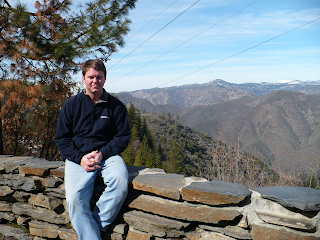
The park was absolutely stunning. It was a bit of a challenge to enjoy as most of the roads were closed and the open ones were somewhat congested as some of the vehicles were not equipped for the snowy conditions. Despite that, there were still amazing views of the sheer cliffs on almost all sides, El Capitan and Half Dome and small waterfalls (they won’t swell until the melt). The closed roads, chaotic parking areas, and most of the trails being closed (several feet of snow) offset the benefit of going to the park in the off-season. The park was so great that I decided that I would like to visit it again, hopefully when I can spend a couple of days, camp, bring a mountain bike, and perhaps a friend or two.

Transit: There is a $20 admission fee to get into Yosemite, to get a seven day pass. I spoke with the ranger collecting the money and asked if the roads were all open – she said they were but there were chain restrictions in place on some of them. Well, perhaps she meant to say that all the roads they intended to open were open – many of the secondary roads were closed as well as Tioga Road – the road I meant to use to pass over the mountain range and into Nevada.

Unfortunately, the Sonora Pass was also closed, so I had to backtrack all the way to Angels Camp (this time I stopped at Twain’s Cabin) and then go North to Rte 88 to cut through. The mountain pass was in great condition, but I came across a snow/rock slide just as CHP and DOT did. The slide was pretty small, but big enough to block most of the Westbound lane so I was glad I got through when I did; after cars were slowing down, but before a traffic jam ensued.

Fallon, NV: I only stopped in Carson City long enough to get the oil changed in the beast, then put a few miles in the rear-view before full night set in. I didn’t elaborate on my dinner at the Model T Diner in Winnemucca, NV a couple weeks ago because it was remarkably unremarkable. But today, I felt like I should have remembered it because I had the exact same experience at Stockman’s in Fallon tonight. It is brightly lit, diner set-up, part of a casino with open air where the smell of smoke comes in easily, the menu is 24 hours, there is a single cashier, and it was recommended as the best meal in town by the hotel staff. I must admit, the food was tasty, albeit undermined by the ambiance.

I took the time after dinner to walk along route 50. Fallon is like a series of strip mall lined against each other with payday loans, discount stores, and lots of beat parking lots and a vacant Wal-Mart store smack dab on the strip. The town does have one thing pulling for it; it is the home of the US Navy’s TOPGUN School, since Miramar went to the Marines in 1996. Good thing Maverick met Charlie before they left romantic San Diego.

pics: a) yosemite falls; b) big ole trees; c) that snowman has gas!; d) stanislaus national forrest


From the notepad:
Day Miles: 322; Trip Miles: 5,902
Fuel consumed 2/7: 15.997 gal
Fuel economy: 20.13 mpg (best on trip!?)
Year Abraham Lincoln originally set the land aside from development: 6/30/1864
Year John Muir, Robert Underwood Johnson successfully lobbied congress for further protection: 10/1/1890
Year Yosemite officially named as a united parcel: 1903
Year Yosemite Sam introduced by Warner Brothers: 1945
Estimated number of visitors to Yosemite 2006: 3.5M
Most popular baby name (male / female) ranks for 2006: Samuel = 25; Samantha = 10*
Number of ‘Yosemite Sam’ jokes to visit the park this year: 21,334**
Elevation (per Roadsign) at Carson Spur pass (Rte 88 in CA): 7,990 ft

*http://www.ssa.gov/OACT/babynames/ (thanks, lance)
**assume visitor statistics are unique visitors, 50/50 distribution male/female, 2006 names representative of all names for all living persons, other derivative ‘sam’ names not statistically relevant, all visitors are American, visitor population names normally distributed in accordance with name distribution and all other assumptions

Thursday, February 7, 2008

February 6, 2008

(Process of making maps disrupted by expiration of Adobe Trial) Over the bridge: I left Bryan’s apartment and took the 101 right over the Golden Gate Bridge to the Napa Valley where I took a detour and stopped at a winery that I have been financially supporting from afar for years – I was hoping to see where my money was going. It was going right back into their till where I was defenseless against their brilliant scheme of making great wine and making it available for sale.

On the wing: When I was approaching Suisun City, it looked like the city was being bombed – in a way it was; a B-52 from Travis Air Force Base was doing touch-and-goes and circling around. My brother Hugh was stationed at Travis in the early 90’s and had told me how it was a boring and motion-sickness inducing activity that he had also endured. It was a theme for the day as I saw a helicopter spraying the vines in Sonoma and a fixed wing plane spraying sod fields near Boldin Island.

Little towns: Going East from Lodi (stuck in Lodi again) there were a lot of wineries, then apple orchards, and finally cattle country. The central valley is considerably different from the California coast. I drove through Angels Camp, CA – home of the Jumping Frog Jamboree every May; thanks to a short story by Mark Twain ‘The Celebrated Jumping Frog of Calaveras County.’ I then drove down Highway 49, first along the Don Pedro Reservoir, then the Merced River – both of which seemed to have water levels that were far below the levels of the shoreline. Then the road climbed into the mountains and I got to the cute town of Mariposa and had a great meal in a ten table restaurant called Savoury’s (the shrimp artichoke bisque was the highlight).


Quote from a new (to me) book from the Mariposa used bookstore:
"... and so there ain't nothing more to write about, and I am rotten glad of it,because if I'd a knowed what a trouble it was to make a book, I wouldn't a tackled it and I ain't a going to no more. But I reckon I got to light out for the Territory ahead of the rest, because Aunt Sally she's going to adopt me and sivilize me and I can't stand it. I been there before." - Mark Twain


Little Pics: a) winter winery, b) a yard-plane near moaning cavern; c) pumping water over the mountain; d) the dry boat ramps for the merced river


Day Miles: 292; Trip Miles: 5,580
Cost of gas Sonoma County, CA: $3.18
MPG PCH to SF: 18.04
Wineries Suggested by Michael: Quintessa, Nickel / Nickel, Farniente, Stags Leap, Silverado, Phelps, Groth
Winneries Visited: Stags Leap
Cost 1 bottle 2005 Artemis: $55.00
Elevation of Terminus, CA: 9ft
Record for longest jump by a frog: 17ft
Year 'The Celebrated Jumping Frog of Calaveras County' published: 1867
Year 'The Adventures of Tom Sawyer' Published: 1876
Visitors to Calaveras County 2003: 40,000
Draw bridges on HWY 12: 3
Animal bust decorations at 49er Miner Bar in Mariposa: zebra, moose, elk, bison, deer, antelope, cheetah, bear, various fish.
Mariposa translated to English: Butterfly
Daisy translated to Spanish: Margarita
Most fun phonetic name visited: Copperopolis, CA